The 32 kilometre long Routeburn Track is an alpine tramping or hiking trail that passes through the Fiordland and Mount Aspiring National Parks

  Loading
Relevance Price Price Rating

Showing 1 to 5 of 5 Offers

Half-Day Routeburn Track Guided Walk from Queenstown

  No Reviews

   5 hours

$401

...

SEE IT

Offered by Viator

Full-Day Routeburn Track Guided Hike from Queenstown

  No Reviews

    10 hours

$664

...

SEE IT

Offered by Viator

Routeburn Track Private Guided Walk from Queenstown

  No Reviews

   7 hours

$211

...

SEE IT

Offered by Viator

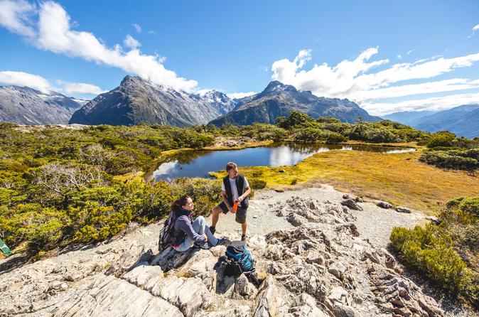
Queenstown: Full-Day Walking Tour on the Routeburn Track

  No Reviews

    9 hour

$124

Enjoy a full-day guided hike along the world-famous Routeburn Track from Queenstown. Learn more abou...

SEE IT

Offered by Get Your Guide

Routeburn Track 1 Day Hike from Queenstown

  No Reviews

 8 to 10 hrs

$170

...

SEE IT

Offered by Viator

Routeburn Track, Queenstown

The 32 kilometre long Routeburn Track is an alpine tramping or hiking trail that passes through the Fiordland and Mount Aspiring National Parks.

The 32 kilometre long Routeburn Track is an alpine tramping or hiking trail that passes through the Fiordland and Mount Aspiring National Parks. The route can be covered in 2 - 4 days, starting from the Routeburn Shelter on the Queenstown side of the Southern Alps going all the way to The Divide. Along the way, you will get breathtaking views of the Bridal Veil Waterfall, Humboldt Mountain, Darren Range, Mount Madeline (2537m), Mount Tutoko (2746m), Hollyford Valley, Lake McKenzie, Lake Harris, Earland Falls, and various other streams, meadows, tarns, waterfalls, and rock formations. There are 4 huts for shelter - Routeburn Flats Hut, Routeburn Falls Hut, Lake Mackenzie Hut, and Lake Howden Hut, as well as camping sites which are only available on pre-booking during the Great Walks season from October to April.


Hours

Sun

NA

Mon

NA

Tue

NA

Wed

NA

Thu

NA

Fri

NA

Sat

NA

About Routeburn Track

 South Island, New Zealand

Routeburn Track and Nearby Sights on Map

Lord of the Rings - Glenorchy

Glenorchy is breathtakingly beautiful, and it is not hard to see why Peter Jackson filmed parts of The Lord of the Rings trilogy here

Skippers Canyon

Carved out by glaciers and the Shotover River, the Skippers Canyon is a breathtaking gorge with steep drops of several hundred metres

Lake Wakatipu

Surrounded by the towering Remarkables, Cecil Peak and Southern Alps, the gorgeous Lake Wakatipu offers breathtaking views of nature

Shotover River

Once dubbed 'the richest river in the world' for its gold nuggets, the Shotover River today draws gold-seekers as well as adventure enthusiasts who come for the fast-flowing crystal rapids

Coronet Peak

Coronet Peak is a 1649 metre tall mountain with a popular skiing resort on its southern slopes

Skycity Queenstown

The Skycity Queenstown Casino has dining and entertainment in addition to 86 gaming machines, 8 gaming tables with popular draws such as Roulette, Poker, Texas Hold'em, Baccarat, and Blackjack, and an additional 4 gaming tables in the VIP room

Hollyford Track

The Hollyford Track is a 56 kilometre long tramping or hiking path along Hollyford River that runs from Marion Corner at the foot of Mount Christina in the south to the Tasman Sea coast at Martins Bay in the north, through the Pyke Big Bay Track

Lake Hayes

Framed by the snow-covered peaks of The Remarkables and mountains of the Wakatipu Basin, Lake Hayes is a picturesque lake with crystal clear waters that reflect the surrounding landscape like a mirror

The Remarkables

You know it is going to be an unforgettable experience when something is named as The Remarkables

Lake Wanaka

Lake Wanaka lies at the heart of the Otago Lakes in South Island, just a 50 minute drive to the north of Queenstown through the Crown Range